The Tracks That Built Portland
How Streetcars Shaped the City and Still Impact Real Estate Today
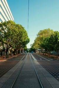
In the late 19th and early 20th centuries, streetcars weren’t just transportation in Portland — they were the framework for how the city grew. Long before highways, freeways, and rideshare apps, Portland’s street railway system determined where people lived, where businesses clustered, and how entire neighborhoods took shape. Today, even though most of the original lines are gone, their imprint is still embedded in the city’s urban form and even its real estate values.
The Rise of the Streetcar Era in Portland

The Horse-Drawn Era: 1872–1888
Portland’s first street railway began operating in 1872, when the Portland Street Railway Company launched a horse-drawn line along First Avenue, connecting downtown with areas to the south. At the time, Portland was expanding beyond its original compact riverfront core. Horse-drawn cars made daily travel more reliable and allowed residents to live slightly farther from their workplaces along the Willamette River waterfront.
These early lines primarily served central Portland, following relatively flat corridors where horses could manage the terrain. But as the city’s population grew, so did the demand for faster and more powerful transit options.
Steam and Cable Experiments: 1880s
In the 1880s, Portland experimented with steam dummy lines and cable cars. Steam-powered lines were used on longer suburban routes where horses were inefficient, particularly toward East Portland (which was still a separate city until 1891 consolidation).
Cable cars, similar to those in San Francisco, were introduced in 1888. Portland’s cable system was relatively short-lived but operated on steep routes, including lines serving Northwest Portland’s hills. The terrain made cable traction useful, but the system was expensive to maintain and quickly became obsolete once electric traction proved more efficient.
Electrification: 1889 and Rapid Expansion
In 1889, Portland introduced its first electric streetcar line. Electrification transformed the system almost overnight. Electric cars were faster, cleaner, more powerful on hills, and far cheaper to operate than horses or cable systems. Within just a few years, most horse and cable lines were converted to electric.
By the early 1910s, Portland had one of the most extensive electric street railway networks in the United States, with more than 200 miles of track. The system stretched far beyond downtown into emerging neighborhoods across both sides of the Willamette River.
Lines extended:
-
North to St. Johns (then an independent city until annexed in 1915)
-
West into Northwest Portland and toward Council Crest
Streetcars crossed the Willamette River on early bridges such as the Steel Bridge (opened 1912), reinforcing downtown as the region’s commercial core while allowing residential districts to flourish outward.
The “Streetcar Suburb” Model
Portland’s growth pattern during this period followed what urban historians call the streetcar suburb model. Developers frequently platted residential subdivisions at the ends of new streetcar lines. In many cases, they actively financed or lobbied for route extensions to increase the value of their land holdings.
Access to a streetcar line was a powerful selling point. Homes within walking distance of a stop were more desirable because they offered reliable transportation to downtown jobs, retail corridors, and waterfront industries. Land values often rose sharply once a line was extended into a new district.
This is why many Portland neighborhoods today still feature:
-
Commercial corridors every half-mile or so
-
Compact, walkable blocks
-
Corner stores and small business clusters
-
Housing density that gradually transitions outward from main streets
Neighborhoods like Sellwood-Moreland, Sunnyside, and parts of Northeast Portland still reflect this original transit-oriented layout.
Where the Lines Went and How They Built Portland’s Neighborhoods
By the 1910s, Portland’s electric street railway system radiated outward from downtown in every direction. Operated largely by the Portland Railway Light & Power Company, the network connected what were once distant settlements into a unified city. Entire neighborhoods were platted, marketed, and sold based on proximity to a streetcar stop.
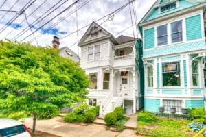
 NW Portland: The Streetcar Suburb That Stayed Relevant
Northwest Portland may be the clearest surviving example of a classic streetcar suburb that never lost its momentum.
Electric lines climbed west from downtown along Burnside and Glisan and ran north–south along corridors such as NW 23rd, NW 21st, and NW Thurman. Early cable cars had helped conquer the hills in the late 1880s, but electrification made the area fully accessible and practical for daily commuting.
Because of this connectivity, the Northwest Portland neighborhoods attracted middle and upper class residents who wanted proximity to downtown without living in the commercial core. Developers built compact lots, narrow streets, and mixed-use commercial hubs every few blocks — all designed around walking to streetcar stops.
Today, the character remains remarkably intact:
-
Victorian and Craftsman homes
-
Small-scale apartment buildings
-
Dense commercial corridors on NW 21st and NW 23rd
-
Walkable blocks built for pedestrians, not cars
For modern buyers, the neighborhood’s value isn’t accidental. It’s the result of transit-first urban planning laid down more than a century ago.
East Portland: From Separate City to Streetcar Grid
Until consolidation in 1891, East Portland was technically its own city. Streetcar bridges and electric lines changed that permanently.
After electrification in 1889, tracks crossed the Willamette River via early bridges and expanded rapidly into the eastside. Neighborhoods like Sunnyside, Laurelhurst, and the areas surrounding Mt. Tabor blossomed between 1890 and 1920.
These became textbook streetcar suburbs:
-
Sidewalk infrastructure
-
Homes oriented toward the street
-
Commercial nodes every half mile along main corridors
Laurelhurst, platted in the early 1900s as an upscale development, was marketed explicitly on its streetcar access. Irvington and Alameda followed similar patterns, attracting affluent buyers who valued both architectural prestige and transit convenience.
Today, many of these eastside neighborhoods remain among Portland’s most stable and competitive real estate markets — in part because their density and layout were designed around walkability from the start.
Sellwood and Westmoreland: Commuter Living Before Cars
Southbound lines followed the Willamette River into Sellwood, which had been an independent town before annexation. Electric service in the 1890s transformed it from a river-adjacent settlement into a viable commuter neighborhood.
Westmoreland developed slightly later, in the 1910s, with curving streets and planned residential lots — still fully dependent on streetcar access to downtown jobs.
St. Johns: A Northern Outpost Connected by Rail
St. Johns operated as its own city until 1915. Streetcar lines reached north along the peninsula well before the St. Johns Bridge was built in 1931.
Early electric lines connected St. Johns to North Portland and downtown via rail corridors and bridges that predated the iconic span we see today. Transit access encouraged industrial growth along the river and residential growth inland.
This is one of Portland’s earliest examples of what we would now call transit-oriented development — dense housing near stops, commercial services clustered around rail access, and strong ties to employment centers.
Irvington and Alameda: Prestige Along the Lines
Irvington, platted beginning in the 1890s, was marketed as an elite residential district. Its broad streets and grand homes were possible because electric streetcars provided reliable downtown access without sacrificing space.
Alameda followed in the early 1900s, capitalizing on elevation and views while remaining connected by streetcar lines running through Northeast Portland.
Streetcar access made these neighborhoods practical. Architecture made them prestigious. The combination still commands premium pricing today.
Montavilla and Mt. Tabor: Growth on the Edge
The Mt. Tabor line extended eastward, opening Montavilla to modest residential growth. Compared to Irvington or Laurelhurst, Montavilla developed as a more middle-income community, but it followed the same template: compact commercial strip, residential grid, walkability.
That structure is one reason Montavilla has seen renewed interest from younger buyers and investors. Its bones were built for density and local commerce long before “walkable neighborhood” became a real estate buzzword.
Hawthorne and the SE Corridor
The Hawthorne corridor developed directly along a streetcar spine running east–west across Southeast Portland.
Because retail clustered around stops, Hawthorne became a mixed-use district early on. Apartment buildings, storefronts, and single-family homes coexisted in close proximity — a pattern that remains intact.
The vibrancy people associate with Hawthorne today is not new. It is the direct descendant of streetcar-era planning.
Goose Hollow: Transit at the Edge of Downtown
Tucked between downtown and Washington Park, Goose Hollow was served by multiple lines climbing toward the West Hills. Cable cars initially handled some of the grade in the late 1880s, later replaced by electric cars.
The result was a dense neighborhood with a mix of boarding houses, apartments, and single-family homes — all within minutes of downtown.
Its compact footprint and transit orientation still define its housing stock and appeal.

The Common Thread: Transit Created Value
Across Portland, the pattern repeated:
-
A line extended outward.
-
Developers platted subdivisions along it.
-
Commercial nodes formed at stops.
-
Property values increased with access.
The 200+ mile electric network didn’t just move people. It organized the city’s growth.
Today, when buyers prioritize walkability, neighborhood retail, and proximity to transit, they are often gravitating toward former streetcar corridors — even if they don’t realize it.
Property Values Then and Now
Historical data from Portland’s real estate archives shows that by the 1920s, home prices near streetcar lines were often 10-20% higher than those further from transit. Fast forward to today, and the pattern holds. Homes in neighborhoods like Irvington, Laurelhurst, and NW Portland consistently fetch above-average prices per square foot. For example:
- NW Portland: Median home value in 2024 were approximately $825,000, compared to the citywide median of $550,000.
- Laurelhurst: Average home price has hovered near $900,000, buoyed by its historic charm and proximity to amenities.
- Sellwood-Moreland: Median prices are over $700,000, up nearly 60% from just a decade ago.
These areas benefit from their human-scale design, established infrastructure, and architectural cohesion—all legacies of the streetcar era.
Adaptive Reuse and Preservation
Many buildings that once sat along streetcar lines have found new life. Former corner stores and apartment buildings now house cafes, boutiques, or have been converted into condos and townhomes. These adaptive reuse projects preserve the charm of the old trolley era while making space for modern living.
In NW Portland, for example, old apartment buildings from the early 20th century have been converted into condos, providing historic yet updated housing options for buyers who want character and convenience. Some still feature original woodwork, brick facades, and ornate iron balconies.
Similarly, old trolley barns and depots have been repurposed for mixed-use development, adding vibrancy to the neighborhoods without erasing their past.
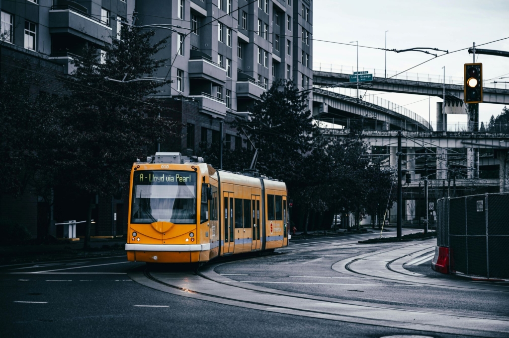
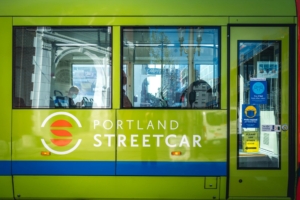
From Decline to Revival: How Streetcars Came Back to Portland
Why the Original System Disappeared
Portland’s electric streetcar network peaked in the 1910s, with more than 200 miles of track connecting neighborhoods across the city. But by the 1920s and 1930s, several forces began reshaping how Portland moved.
The automobile changed everything. As car ownership increased, city leaders and planners began prioritizing road expansion over rail maintenance. Buses were cheaper and more flexible than maintaining fixed tracks. The Great Depression strained private transit operators financially. By the 1940s, many lines were converted to buses or trolley buses.
After World War II, federal highway funding accelerated the shift. Like many American cities, Portland embraced automobile infrastructure. Streetcars were gradually dismantled, and by 1950 the last electric streetcar lines were gone.
Yet even as the tracks disappeared, the neighborhoods they created endured. Northwest Portland, Sellwood, Irvington, Hawthorne, and others retained their walkable grids and commercial corridors — physical reminders of transit-oriented planning.
The Pearl District: Rail Yards to Residential Towers
Perhaps the clearest example of streetcar-driven redevelopment is the Pearl District.
Once dominated by rail yards and industrial warehouses, the Pearl in the 1990s was largely underutilized land north of downtown. City planners intentionally aligned the new streetcar route through the district to support redevelopment goals.
What followed was transformative:
-
Warehouse conversions into lofts
-
Mid-rise and high-rise condo construction
-
New retail corridors along NW 10th and 11th
-
Parks and public spaces woven into dense housing
Developers took notice quickly. Proximity to the streetcar became a marketing feature. Condo towers replaced industrial buildings. Property values rose significantly as demand for walkable, transit-connected living increased.
In many ways, the Pearl District mirrors how Irvington and Laurelhurst were marketed a century earlier — only this time, vertical density replaced single-family homes.
South Waterfront: Planned Growth Around Transit
The South Waterfront offers a second example of transit guiding development.
Before the 2000s, the area south of downtown along the Willamette River was largely industrial and underdeveloped. The extension of the Portland Streetcar into the district, combined with zoning changes and major institutional investments such as Oregon Health & Science University, set the stage for high-rise residential growth.
Today, South Waterfront is one of Portland’s newest high-density neighborhoods, defined by residential towers, riverfront access, mixed-use development, and direct streetcar connectivity to downtown.
As in the early 1900s, transit access signaled long-term viability and investment stability.
Does Proximity to the Streetcar Still Matter?
Urban development research in Portland has consistently shown that properties located within roughly a quarter mile of the modern streetcar line have experienced stronger appreciation and rental performance compared to areas farther away.
Why?
Because proximity to fixed transit infrastructure:
-
Reduces reliance on cars
-
Signals long-term municipal investment
-
Supports nearby retail and commercial activity
-
Enhances walkability scores
-
Creates predictable development patterns
For real estate investors and homebuyers, this isn’t just convenience — it’s an indicator of sustained demand.
Conclusion: The Rails That Still Guide Portland Real Estate
Portland’s streetcars may be gone in their original form, but the city they built is very much intact.
From the compact blocks of Northwest to the stately homes of Laurelhurst, from the mixed-use energy of Hawthorne to the riverfront towers of the Pearl District, Portland’s most desirable neighborhoods were shaped first by steel rails and electric wires. The streetcar didn’t just move people — it organized growth, established commercial corridors, and set the pattern for walkability that still defines the city’s livability.
When the original system declined mid-century, the neighborhoods it created endured. When the Portland Streetcar returned in 2001, it revived the same principle: transit as a catalyst for long-term value. The Pearl District and South Waterfront prove that proximity to fixed rail continues to signal stability, demand, and appreciation.
For buyers and investors, this history isn’t nostalgic trivia. It’s a roadmap.
Many of Portland’s most competitive real estate markets today trace directly back to historic streetcar corridors. The same factors that drove demand in 1910 — access, walkability, neighborhood retail, connectivity to downtown — remain powerful value indicators in 2026.
If you’re considering buying or investing in Portland real estate, it helps to understand where the tracks once ran — and where they run today. Explore neighborhoods like Northwest Portland, Laurelhurst, Sellwood-Moreland, or the Pearl District with an eye toward the infrastructure that shaped them.
Because in Portland, the old routes still point toward smart real estate decisions.
Thinking about your next move? Connect with a local real estate agent who understands how Portland’s past continues to shape its future.